Title: National Hydrography Dataset (NHD) 1:24,000
Originator: United States Geologic Survey
Abstract:
The U.S. Geological Survey has developed a National Hydrography Dataset (NHD). The NHD is a comprehensive set of digital spatial data that contains information about surface water features such as lakes, ponds, streams, rivers, springs and wells. Within the NHD, surface water features are combined to form "reaches," which provide the framework for linking water-related data to the NHD surface water drainage network. These linkages enable the analysis and display of these water-related data in upstream and downstream order.
The NHD is based upon the content of USGS Digital Line Graph (DLG) hydrography data integrated with reach-related information from the EPA Reach File Version 3 (RF3). The NHD supersedes DLG and RF3 by incorporating them, not by replacing them. Users of DLG or RF3 will find the National Hydrography Dataset both familiar and greatly expanded and refined.
The NHD is a national framework for assigning reach addresses to water-related entities, such as industrial discharges, drinking water supplies, fish habitat areas, wild and scenic rivers. Reach addresses establish the locations of these entities relative to one another within the NHD surface water drainage network, much like addresses on streets. Once linked to the NHD by their reach addresses, the upstream/downstream relationships of these water-related entities--and any associated information about them--can be analyzed using software tools ranging from spreadsheets to geographic information systems (GIS). GIS can also be used to combine NHD-based network analysis with other data layers, such as soils, land use and population, to help understand and display their respective effects upon one another. Furthermore, because the NHD provides a nationally consistent framework for addressing and analysis, water-related information linked to reach addresses by one organization (national, state, local) can be shared with other organizations and easily integrated into many different types of applications to the benefit of all.
While initially based on 1:100,000-scale data, the NHD is designed to incorporate and encourage the development of higher resolution data required by many users. The NHD is a living dataset that is updated bimonthly to incorporate the "best available" data. The NHD also incorporates the National Spatial Data Infrastructure framework criteria established by the Federal Geographic Data Committee.
The dataset is provided in essentially two resolutions at this time. The first is the “medium” resolution based on the 100K scale data; the second is the “high” resolution based on the 24K scale data. As higher resolution data becomes available from state and local governments and other sources, a third category will become more and more common – “local” resolution data.
Upto six (where data is available) layers are provided for each area:
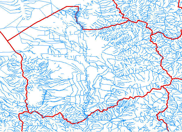
Flowline(st) - stream/river, canal/ditch, pipeline, connector, underground conduit, and coastline.
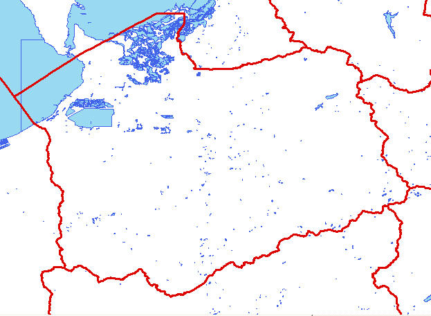
Waterbody(wb) - lake/pond, swamp/marsh, reservoir, playa, estuary, and ice mass.
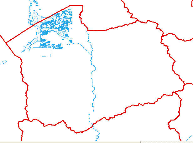
Area(ar) - the geometric extent of the water in a wide stream/river, inundation area, area to be submerged, bay/inlet, ocean.
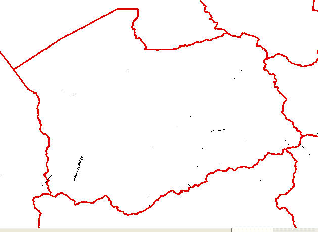
Line(li) - linear features not core to the network such as flume, gate, reef, tunnel, dam.
Point(pt) - hydrography related point features such as spring, well, water intake/outflow.
Point Event(pe) - gaging station, dam point and live hyperlinks to all USGS gaging stations.
To model up/down stream flow using the built in no additional cost Utility Network Analyst extension in ArcMap, order
ESRI File GeoDatabase Format and the network will be pre-built as a layer if there are less than 100,000 features.
Typically, features are delivered as layers in the area of interest. If delivery by Hydrologic unit is desired, select the Separate ESRI Shape file or Separate ESRI File GeoDataBase Class format option to receive separate layers by HUC.
For a complete listing of Features and codes in each layer, go to: https://nhd.usgs.gov/NHDinGEO_FCodes_by_layer.pdf
The NHD home, https://nhd.usgs.gov/ provides a great deal of information about the NHD. The
USGS maintains a web service for NHD here.
Format: vector point, line and area – ESRI Shape File and File GeoDataBase
Spatial Reference Information: Decimal Degrees, North American Datum 1983
Sample Flowline Sample Waterbody Sample Area Sample Line Sample Point